


PRECINCT MIAMI-C, Montgomery County, Ohio
About
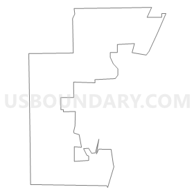
Outline
Summary
| Unique Area Identifier | 650666 |
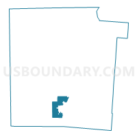
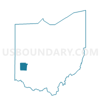
| Name | PRECINCT MIAMI-C |
| County | Montgomery County |
| State | Ohio |
| Area (square miles) | 6.11 |
| Land Area (square miles) | 6.03 |
| Water Area (square miles) | 0.08 |
| % of Land Area | 98.62 |
| % of Water Area | 1.38 |
| Latitude of the Internal Point | 39.62247890 |
| Longtitude of the Internal Point | -84.31127660 |
Maps

Graphs
Select a template below for downloading or customizing gragh for PRECINCT MIAMI-C, Montgomery County, Ohio


Neighbors
Neighoring Voting District (by Name) Neighboring Voting District on the Map
- PRECINCT GERMAN-A, Montgomery County, OH
- PRECINCT GERMAN-C, Montgomery County, OH
- PRECINCT JEFFERSON-D, Montgomery County, OH
- PRECINCT MIAMI-T, Montgomery County, OH
- PRECINCT MIAMISBURG 1-A, Montgomery County, OH
- PRECINCT MIAMISBURG 1-B, Montgomery County, OH
- PRECINCT MIAMISBURG 1-C, Montgomery County, OH
- PRECINCT MIAMISBURG 2-A, Montgomery County, OH
- PRECINCT MIAMISBURG 2-B, Montgomery County, OH
- PRECINCT MIAMISBURG 2-D, Montgomery County, OH
- PRECINCT MORAINE 2-B, Montgomery County, OH
- PRECINCT W CARROLLTON-A, Montgomery County, OH
- PRECINCT W CARROLLTON-B, Montgomery County, OH
Top 10 Neighboring County Subdivision (by Population) Neighboring County Subdivision on the Map
- Miami township, Montgomery County, OH (50,735)
- West Carrollton city, Montgomery County, OH (13,143)
- German township, Montgomery County, OH (8,429)
- Jefferson township, Montgomery County, OH (6,972)
- Moraine city, Montgomery County, OH (6,307)
Top 10 Neighboring Place (by Population) Neighboring Place on the Map
Top 10 Neighboring Unified School District (by Population) Neighboring Unified School District on the Map
- Miamisburg City School District, OH (38,854)
- West Carrollton City School District, OH (27,649)
- Valley View Local School District, OH (10,658)
- Carlisle Local School District, OH (9,646)
- Jefferson Township Local School District, OH (6,691)
Top 10 Neighboring State Legislative District Lower Chamber (by Population) Neighboring State Legislative District Lower Chamber on the Map
- State House District 37, OH (114,471)
- State House District 36, OH (111,134)
- State House District 39, OH (92,594)
Top 10 Neighboring State Legislative District Upper Chamber (by Population) Neighboring State Legislative District Upper Chamber on the Map
Top 10 Neighboring 111th Congressional District (by Population) Neighboring 111th Congressional District on the Map
Top 10 Neighboring Census Tract (by Population) Neighboring Census Tract on the Map
- Census Tract 1650, Montgomery County, OH (6,523)
- Census Tract 503.02, Montgomery County, OH (5,324)
- Census Tract 506, Montgomery County, OH (3,835)
- Census Tract 503.01, Montgomery County, OH (3,304)
- Census Tract 505.02, Montgomery County, OH (2,891)
- Census Tract 601, Montgomery County, OH (2,887)